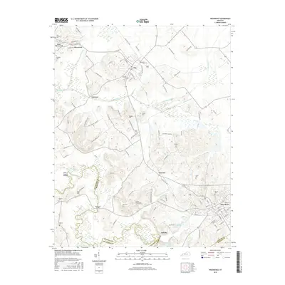
2016 Map of Providence
USGS Topo · Published 2016About this map
The city of Providence anchors this 2016 survey, where the rolling hills of Webster County meet the winding course of the Tradewater River. This area is defined by a legacy of resource extraction and local industry, evidenced by features like the Oyama Mine and the extensive network of utility roads such as Fairmont Mine Rd. The terrain is punctuated by significant elevations like Big Hill and Green Grove Hill, while the lowlands are drained by Craborchard Creek and Slover Cr.
Find a feature on this map
104 named features on this map. Tap any name to fly to it.
Don’t see what you’re looking for? This feature index may not catch every label — zoom into the map to look around manually.
Map Details
Editions of this 2016 Providence Map
This is the sole edition of this map. No revisions or reprints were ever made.
Other maps of this area

1906 · Sebree
USGS Topo · 1:62,500

1907 · Earlington
USGS Topo · 1:48,000

1907 · Morganfield
USGS Topo · 1:62,500

1909 · Earlington
USGS Topo · 1:62,500

1909 · Providence
USGS Topo · 1:62,500

1951 · Dixon
USGS Topo · 1:24,000
1951 · Bordley
USGS Topo · 1:24,000

1951 · Sturgis
USGS Topo · 1:24,000

1954 · Evansville
USGS Topo · 1:250,000
1954 · Nebo
USGS Topo · 1:24,000