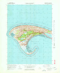
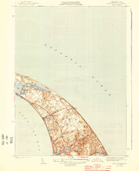
1972 Map of Provincetown
USGS Topo · Published 1978About this map
Provincetown occupies the narrow, hooked tip of the peninsula in this early 1970s survey, showing a landscape defined by the shifting sands of the Cape Cod National Seashore. The map highlights the town's compact settlement along the curve of Provincetown Harbor, contrasted with the expansive wetlands and dune systems to the north and west. Notable features include the Provincetown Municipal Airport and the Race Point Coast Guard Sta, representing the critical transportation and maritime safety infrastructure of the era. The interior is dotted with numerous freshwater bodies like Shank Painter Pond and Duck Pond, while the eastern portion is dominated by the large Pilgrim Lake. Significant landmarks such as Telegraph Hill and Mt Ararat stand out against the low-lying shoreline, which is fringed by Race Point Beach and the protective arm of Long Point.
Find a feature on this map
37 named features on this map. Tap any name to fly to it.
Don’t see what you’re looking for? This feature index may not catch every label — zoom into the map to look around manually.
Map Details
Editions of this 1972 Provincetown Map
4 editions found
Other maps of this area

1887 · Wellfleet
USGS Topo · 1:62,500

1887 · Provincetown
USGS Topo · 1:62,500

1889 · Provincetown
USGS Topo · 1:62,500

1889 · Wellfleet
USGS Topo · 1:62,500

1893 · Wellfleet
USGS Topo · 1:62,500

1898 · Provincetown
USGS Topo · 1:62,500

1942 · Cape Cod Bay
USGS Topo · 1:125,000

1944 · Provincetown
USGS Topo · 1:31,680
1944 · North Truro
USGS Topo · 1:31,680

1947 · Providence
USGS Topo · 1:250,000