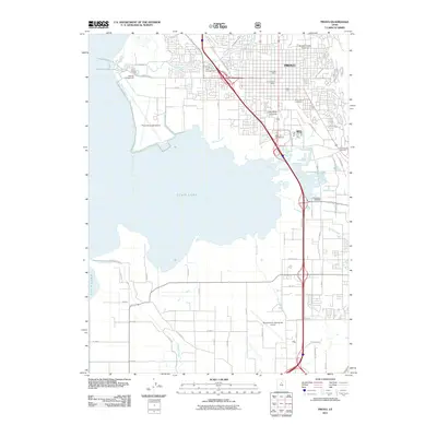
2011 Map of Provo
USGS Topo · Published 2011About this map
Utah Lake dominates the western horizon of this 2011 survey, where the freshwater shoreline meets the dense urban expansion of Provo. The geography is defined by a sophisticated network of water management and institutional growth, featuring major academic campuses like Brigham Young University and Utah Valley University. The map documents the city's civic infrastructure, from the Provo City Cemetery and Utah County Infirmary to vital transportation hubs such as the Provo Municipal Airport. Irrigation and drainage systems are intricately mapped, showing the Lake Bottom Canal, Mill Race, and the winding course of the Provo River as it enters the lake. To the south, the landscape transitions toward the Spanish Fork- Springville Airport, bordered by numerous agricultural roads and creeks like Hobble Creek and Dry Creek that descend from the eastern highlands toward the basin floor.
Find a feature on this map
58 named features on this map. Tap any name to fly to it.
Don’t see what you’re looking for? This feature index may not catch every label — zoom into the map to look around manually.
Map Details
Editions of this 2011 Provo Map
This is the sole edition of this map. No revisions or reprints were ever made.
Other maps of this area

1885 · Salt Lake
USGS Topo · 1:250,000

1948 · Spanish Fork
USGS Topo · 1:24,000

1948 · Orem
USGS Topo · 1:24,000

1948 · Orem
USGS Topo · 1:62,500

1948 · Springville
USGS Topo · 1:24,000

1948 · Provo
USGS Topo · 1:24,000

1948 · Bridal Veil Falls
USGS Topo · 1:24,000

1949 · Provo
USGS Topo · 1:62,500

1949 · Spanish Fork Peak
USGS Topo · 1:24,000

1950 · Orem
USGS Topo · 1:24,000