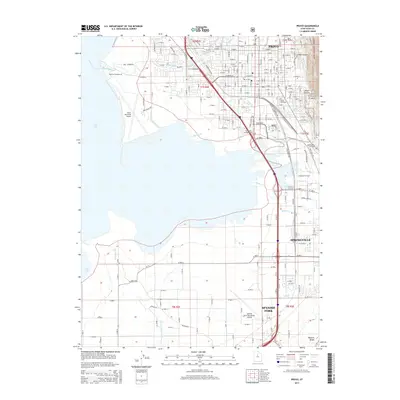
2014 Map of Provo
USGS Topo · Published 2014About this map
Utah Lake defines the western edge of this corridor, where the residential and industrial centers of Provo, Springville, and Spanish Fork sit positioned between the shoreline and the rising peaks of the Wasatch Range. The landscape is a complex network of water management and transportation, including the Provo River and Spanish Fork River, alongside man-made features like the Lake Bottom Canal and Mill Race. The map provides significant detail for local researchers, identifying the Provo City Cem and the Utah County Infirmary. To the east, the terrain transitions sharply into the Uinta National Forest, marked by rugged features such as Slate Canyon and Slide Canyon. Aviation hubs are well-represented by the Provo Municipal Airport on the lake's edge and the Spanish Fork-Springville Airport further south.
Find a feature on this map
215 named features on this map. Tap any name to fly to it.
Don’t see what you’re looking for? This feature index may not catch every label — zoom into the map to look around manually.
Map Details
Editions of this 2014 Provo Map
This is the sole edition of this map. No revisions or reprints were ever made.
Other maps of this area

1885 · Salt Lake
USGS Topo · 1:250,000

1948 · Spanish Fork
USGS Topo · 1:24,000

1948 · Orem
USGS Topo · 1:24,000

1948 · Orem
USGS Topo · 1:62,500

1948 · Springville
USGS Topo · 1:24,000

1948 · Provo
USGS Topo · 1:24,000

1948 · Bridal Veil Falls
USGS Topo · 1:24,000

1949 · Provo
USGS Topo · 1:62,500

1949 · Spanish Fork Peak
USGS Topo · 1:24,000

1950 · Orem
USGS Topo · 1:24,000