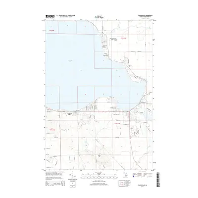
2014 Map of Prudenville
USGS Topo · Published 2014About this map
Houghton Lake dominates the western half of this Roscommon County landscape, serving as the central geographic feature for the surrounding communities in the mid-2010s. The settlement of Prudenville sits at the southeastern corner of the lake, where a dense network of local roads such as W Houghton Lake Dr and Main St indicates a well-established residential and commercial hub. South of the main town center, Prudenville Cem and Emery Hill provide local landmarks among the rising terrain.
Find a feature on this map
96 named features on this map. Tap any name to fly to it.
Don’t see what you’re looking for? This feature index may not catch every label — zoom into the map to look around manually.
Map Details
Editions of this 2014 Prudenville Map
This is the sole edition of this map. No revisions or reprints were ever made.
Other maps of this area

1954 · Traverse City
USGS Topo · 1:250,000

1956 · Houghton Lake
USGS Topo · 1:62,500

1957 · Harrison
USGS Topo · 1:62,500

1958 · Traverse City
USGS Topo · 1:250,000

1963 · Roscommon South
USGS Topo · 1:24,000

1963 · Backus Lake
USGS Topo · 1:24,000

1963 · Prudenville
USGS Topo · 1:24,000
1963 · Lyon Manor
USGS Topo · 1:24,000

1969 · Meredith NW
USGS Topo · 1:24,000

1969 · Meredith
USGS Topo · 1:24,000