
1963 Map of Backus Lake
USGS Topo · Published 1964About this map
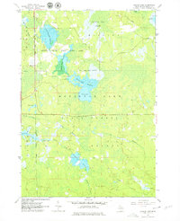
Backus Creek State Game Area and the Houghton Lake State Forest define this mid-century landscape in Roscommon County, showing a region managed for conservation and natural resources. The map highlights extensive wetland engineering, notably through several flooding projects including Backus Lake Flooding, Little Mud Lake Flooding, and Denton Creek Flooding. These man-made adjustments to the water table altered the local drainage patterns of the North Branch Denton Creek and Backus Creek, likely to support waterfowl and local ecosystems.
Find a feature on this map
20 named features on this map. Tap any name to fly to it.
Don’t see what you’re looking for? This feature index may not catch every label — zoom into the map to look around manually.
Map Details
Editions of this 1963 Backus Lake Map

Other maps of this area

1954 · Traverse City
USGS Topo · 1:250,000

1958 · Traverse City
USGS Topo · 1:250,000

1963 · Roscommon South
USGS Topo · 1:24,000

1963 · Prudenville
USGS Topo · 1:24,000
1963 · Lyon Manor
USGS Topo · 1:24,000

1965 · St. Helen NW
USGS Topo · 1:24,000

1965 · St. Helen
USGS Topo · 1:24,000

1969 · Meredith NW
USGS Topo · 1:24,000

1969 · Meredith
USGS Topo · 1:24,000

1969 · Butman
USGS Topo · 1:24,000