
1969 Map of Meredith
USGS Topo · Published 1971About this map
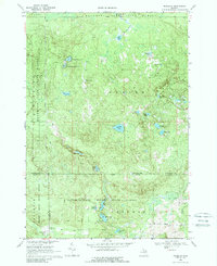
Meredith stands as the primary settlement in this late 1960s landscape, positioned near the intersection of the Roscommon, Clare, and Gladwin county lines. The area is defined by the convergence of several state-managed lands, including the Houghton Lake State Forest, Tittabawassee River State Forest, and Chippewa River State Forest. The terrain is characterized by a dense network of small glacial lakes and wetlands, such as Hoister Lake and Rollway Lake, which are interconnected by primitive roads and a grade that suggests a history of timber extraction or early infrastructure.
Find a feature on this map
40 named features on this map. Tap any name to fly to it.
Don’t see what you’re looking for? This feature index may not catch every label — zoom into the map to look around manually.
Map Details
Editions of this 1969 Meredith Map
2 editions found
Other maps of this area

1954 · Traverse City
USGS Topo · 1:250,000

1958 · Traverse City
USGS Topo · 1:250,000

1963 · Backus Lake
USGS Topo · 1:24,000

1963 · Prudenville
USGS Topo · 1:24,000

1965 · St. Helen
USGS Topo · 1:24,000

1969 · Meredith NW
USGS Topo · 1:24,000

1969 · Butman
USGS Topo · 1:24,000

1969 · Wagarville
USGS Topo · 1:24,000

1969 · Meredith SW
USGS Topo · 1:24,000
1969 · Skeels
USGS Topo · 1:24,000