
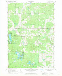
1969 Map of Meredith SW
USGS Topo · Published 1971About this map
The Chippewa River State Forest dominates this section of Michigan, where the intersections of Frost, Franklin, Hayes, and Hamilton townships meet. In the late 1960s, this area north of Harrison shows a landscape shaped by natural drainage and resource extraction, notably featuring an extensive Oil and Gas Field and numerous Gravel Pits. Local infrastructure is anchored by the Meredith settlement and essential community landmarks like the Amble Sch, the Church of God in Christ, and the Hamilton Cem.
Find a feature on this map
47 named features on this map. Tap any name to fly to it.
Don’t see what you’re looking for? This feature index may not catch every label — zoom into the map to look around manually.
Map Details
Editions of this 1969 Meredith SW Map
2 editions found
Other maps of this area

1954 · Traverse City
USGS Topo · 1:250,000

1954 · Midland
USGS Topo · 1:250,000

1957 · Harrison
USGS Topo · 1:62,500

1958 · Traverse City
USGS Topo · 1:250,000

1958 · Midland
USGS Topo · 1:250,000

1959 · Midland
USGS Topo · 1:250,000

1959 · Clare
USGS Topo · 1:62,500

1966 · Midland
USGS Topo · 1:250,000

1969 · Meredith NW
USGS Topo · 1:24,000

1969 · Meredith
USGS Topo · 1:24,000