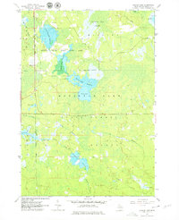
1963 Map of Backus Lake
USGS Topo · Published 1979About this map
The Backus Creek State Game Area and Houghton Lake State Forest dominate this mid-century landscape in Roscommon County, characterized by an intricate network of wetlands and managed water levels. The presence of multiple flooding zones, including Little Mud Lake Flooding, Backus Creek Flooding, and Denton Creek Flooding, illustrates the mid-20th-century focus on wildlife habitat management and water control in Michigan's lower peninsula.
Find a feature on this map
24 named features on this map. Tap any name to fly to it.
Don’t see what you’re looking for? This feature index may not catch every label — zoom into the map to look around manually.
Map Details
Editions of this 1963 Backus Lake Map

Other maps of this area

1954 · Traverse City
USGS Topo · 1:250,000

1958 · Traverse City
USGS Topo · 1:250,000

1963 · Roscommon South
USGS Topo · 1:24,000

1963 · Backus Lake
USGS Topo · 1:24,000

1963 · Prudenville
USGS Topo · 1:24,000
1963 · Lyon Manor
USGS Topo · 1:24,000

1965 · St. Helen NW
USGS Topo · 1:24,000

1965 · St. Helen
USGS Topo · 1:24,000

1969 · Meredith NW
USGS Topo · 1:24,000

1969 · Meredith
USGS Topo · 1:24,000