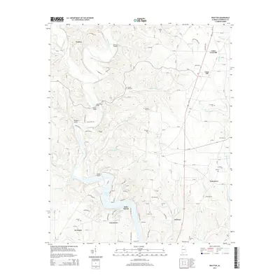
2014 Map of Pruitton
USGS Topo · Published 2014About this map
Shoal Creek meanders southward through Lauderdale County, eventually widening into the expansive waters of Wilson Lake near the community of Falconhead. This 2014 survey documents a landscape where agricultural heritage meets modern rural residential growth, particularly evident around St. Florian and the riverside developments of Waters Edge Dr. The map is a vital resource for genealogists and local historians, meticulously recording numerous family-named landmarks and burial grounds, including the Emaline Stutts Cem, Oak Hill Cem, and Cauhorn Cem. At the northern end, the settlement of Pruitton remains connected by the historic corridor of Old Savannah Rd, while the crossing at Goose Shoals Bridge highlights the area's long-standing reliance on its watercourses. Diverse springs and branches, such as Mint Springs and Brotherick Br, weave through the terrain, defining the local topography.
Find a feature on this map
74 named features on this map. Tap any name to fly to it.
Don’t see what you’re looking for? This feature index may not catch every label — zoom into the map to look around manually.
Map Details
Editions of this 2014 Pruitton Map
This is the sole edition of this map. No revisions or reprints were ever made.
Other maps of this area

1905 · Waynesboro
USGS Topo · 1:125,000

1914 · Rogersville
USGS Topo · 1:48,000

1914 · Muscle Shoals
USGS Topo · 1:48,000

1916 · Muscle Shoals
USGS Topo · 1:62,500

1916 · Rogersville
USGS Topo · 1:62,500

1936 · Light
USGS Topo · 1:24,000

1936 · Loretto
USGS Topo · 1:24,000

1936 · Pruitton
USGS Topo · 1:24,000

1936 · Wheeler Dam
USGS Topo · 1:24,000

1936 · Florence
USGS Topo · 1:24,000