
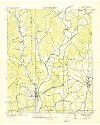
1936 Map of Pruitton
USGS Topo · Published 1936About this map
Wilson Reservoir dominates the lower landscape of this Lauderdale County survey, marking a period of significant transition as the Tennessee Valley Authority established its footprint. The map documents an area defined by the winding course of Shoal Creek and the intricate network of the Louisville and Nashville Line railroad. Rural life is meticulously recorded through numerous community nodes such as Pruitton, Upper Green Hill, and Bailey Springs. Local genealogy is well-served by the inclusion of numerous small country landmarks, including Crystal Springs Ch, Lone Cedar Ch, and Pleasant Grove Cem. Practical river crossings like Savannah Ford and the Goose Shoals Bridge highlight the traditional infrastructure existing alongside the newer hydroelectric developments of the 1930s.
Find a feature on this map
52 named features on this map. Tap any name to fly to it.
Don’t see what you’re looking for? This feature index may not catch every label — zoom into the map to look around manually.
Map Details
Editions of this 1936 Pruitton Map
This is the sole edition of this map. No revisions or reprints were ever made.
Other maps of this area

1905 · Waynesboro
USGS Topo · 1:125,000

1914 · Rogersville
USGS Topo · 1:48,000

1914 · Muscle Shoals
USGS Topo · 1:48,000

1916 · Muscle Shoals
USGS Topo · 1:62,500

1916 · Rogersville
USGS Topo · 1:62,500

1936 · Light
USGS Topo · 1:24,000

1936 · Loretto
USGS Topo · 1:24,000

1936 · Wheeler Dam
USGS Topo · 1:24,000

1936 · Florence
USGS Topo · 1:24,000
1936 · St. Joseph
USGS Topo · 1:24,000