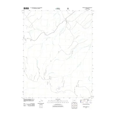
2011 Map of Pryor Creek
USGS Topo · Published 2011About this map
Donley Camp sits at the western edge of this drainage system, where the network of mountain waters begins its descent through Montrose County. The landscape is defined by the convergence of numerous forks and branches, including Pryor Creek, Beaver Dams Creek, and Cottonwood Creek. A complex system of forest and local roads, such as Divide Rd and 90 Rd, provides access to these high elevations and water sources.
Find a feature on this map
37 named features on this map. Tap any name to fly to it.
Don’t see what you’re looking for? This feature index may not catch every label — zoom into the map to look around manually.
Map Details
Editions of this 2011 Pryor Creek Map
This is the sole edition of this map. No revisions or reprints were ever made.
Other maps of this area

1909 · Montrose
USGS Topo · 1:125,000

1911 · Montrose
USGS Topo · 1:125,000

1956 · Montrose
USGS Topo · 1:250,000

1956 · Moab
USGS Topo · 1:250,000

1959 · Moab
USGS Topo · 1:250,000

1959 · Montrose
USGS Topo · 1:250,000

1960 · Montrose
USGS Topo · 1:250,000

1960 · Moab
USGS Topo · 1:250,000

1962 · Moab
USGS Topo · 1:250,000
1962 · Montrose West
USGS Topo · 1:24,000