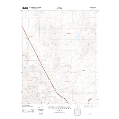
2013 Map of Pryor
USGS Topo · Published 2013About this map
Pryor and its neighboring settlements sit along the border of Huerfano and Las Animas counties, defined by a landscape of deep canyons and prominent mesas. The map documents the persistent agricultural and ranching footprint of the region, anchored by sites like Capps Ranch and the water management systems of Gomez Ditch and Levy Reservoir. The topographical relief is dominated by Saliba Mesa and the winding course of Santa Clara Cr, which provides the primary drainage for the surrounding highlands.
Find a feature on this map
37 named features on this map. Tap any name to fly to it.
Don’t see what you’re looking for? This feature index may not catch every label — zoom into the map to look around manually.
Map Details
Editions of this 2013 Pryor Map
This is the sole edition of this map. No revisions or reprints were ever made.
Other maps of this area

1891 · Walsenburg
USGS Topo · 1:125,000

1891 · Spanish Peaks
USGS Topo · 1:125,000

1893 · Spanish Peaks
USGS Topo · 1:125,000

1894 · Walsenburg
USGS Topo · 1:125,000

1895 · Spanish Peaks
USGS Topo · 1:125,000

1897 · Walsenburg
USGS Topo · 1:125,000

1897 · Spanish Peaks
USGS Topo · 1:125,000

1900 · Spanish Peaks
USGS Topo · 1:125,000

1900 · Walsenburg
USGS Topo · 1:125,000

1954 · Trinidad
USGS Topo · 1:250,000