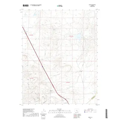
2019 Map of Pryor
USGS Topo · Published 2019About this map
The southern Colorado landscape near the border of Huerfano and Las Animas counties is defined by a series of mesas and drainages, most notably Saliba Mesa and the winding Santa Clara Cr. The settlement of Pryor and the neighboring area of Monson sit at the mouth of Pryor Canyon, where the rugged terrain meets a growing network of local roads including Silver Spur Rd and Trailsend Rd. This map reveals a transition from traditional agricultural and ranching infrastructure, like the Gomez Ditch and Farr Lake in the north, to modern residential developments and named landmarks.
Find a feature on this map
40 named features on this map. Tap any name to fly to it.
Don’t see what you’re looking for? This feature index may not catch every label — zoom into the map to look around manually.
Map Details
Editions of this 2019 Pryor Map
This is the sole edition of this map. No revisions or reprints were ever made.
Other maps of this area

1891 · Walsenburg
USGS Topo · 1:125,000

1891 · Spanish Peaks
USGS Topo · 1:125,000

1893 · Spanish Peaks
USGS Topo · 1:125,000

1894 · Walsenburg
USGS Topo · 1:125,000

1895 · Spanish Peaks
USGS Topo · 1:125,000

1897 · Walsenburg
USGS Topo · 1:125,000

1897 · Spanish Peaks
USGS Topo · 1:125,000

1900 · Spanish Peaks
USGS Topo · 1:125,000

1900 · Walsenburg
USGS Topo · 1:125,000

1954 · Trinidad
USGS Topo · 1:250,000