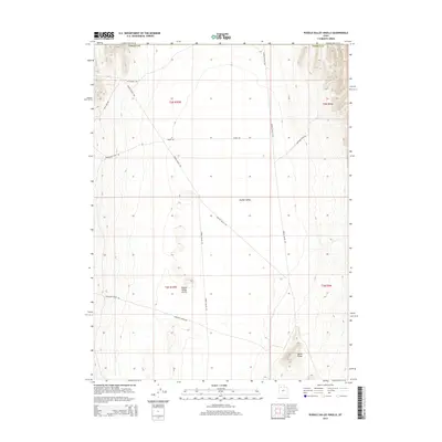
2014 Map of Puddle Valley Knolls
USGS Topo · Published 2014About this map
Puddle Valley dominates this arid landscape in Tooele County, where remote desert tracks and historical corridors cross the basin floor. The terrain is defined by the central Puddle Valley Knolls and the rising contours of Skunk Ridge to the southeast. A network of roads reveals the human transit through this basin, including the north-south Puddle Valley Hwy and the diagonal track of Alkaline Valley Rd. The presence of Jedediah Smith Rd and Lowland Cutoff Rd highlights the area's significance for regional travel, marking routes that avoid the more difficult mountainous terrain nearby. This 2014 survey documents the enduring paths and topographic landmarks that have guided travelers through the West Desert for generations.
Find a feature on this map
17 named features on this map. Tap any name to fly to it.
Don’t see what you’re looking for? This feature index may not catch every label — zoom into the map to look around manually.
Map Details
Editions of this 2014 Puddle Valley Knolls Map
This is the sole edition of this map. No revisions or reprints were ever made.
Other maps of this area

1885 · Tooele Valley
USGS Topo · 1:250,000

1953 · Tooele
USGS Topo · 1:250,000

1954 · Brigham City
USGS Topo · 1:250,000

1955 · Tooele
USGS Topo · 1:250,000

1958 · Brigham City
USGS Topo · 1:250,000

1962 · Brigham City
USGS Topo · 1:250,000

1968 · Deardens Knoll
USGS Topo · 1:24,000

1968 · Craner Peak
USGS Topo · 1:24,000

1973 · Ripple Valley
USGS Topo · 1:24,000

1973 · Grassy Mountains
USGS Topo · 1:24,000