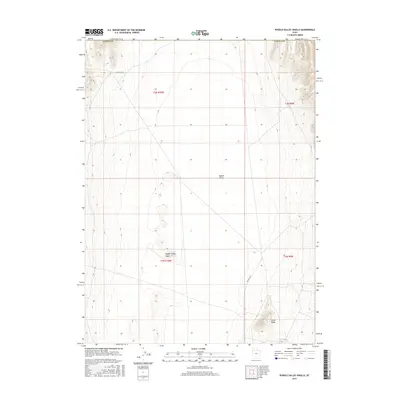
2017 Map of Puddle Valley Knolls
USGS Topo · Published 2017About this map
Puddle Valley dominates this Tooele County landscape, showing the arid basin floor defined by subtle elevation shifts and isolated landforms. Central to this area are the Puddle Valley Knolls, a series of small, distinct rises that break the flat valley bottom between the larger mountain ranges. The northern portion of the map is traversed by N Lakeside Dr, while a Frontage Rd skirts the eastern boundary near Skunk Ridge. This 2017 survey reflects the contemporary topographic detail of the Great Salt Lake Desert periphery, where land management and natural terrain dictate the layout of the sparse road network. The map reveals the intricate contouring of the knolls, providing a precise record of these geologic features in an area where even minor changes in relief serve as critical landmarks for navigation and land use.
Find a feature on this map
10 named features on this map. Tap any name to fly to it.
Don’t see what you’re looking for? This feature index may not catch every label — zoom into the map to look around manually.
Map Details
Editions of this 2017 Puddle Valley Knolls Map
This is the sole edition of this map. No revisions or reprints were ever made.
Other maps of this area

1885 · Tooele Valley
USGS Topo · 1:250,000

1953 · Tooele
USGS Topo · 1:250,000

1954 · Brigham City
USGS Topo · 1:250,000

1955 · Tooele
USGS Topo · 1:250,000

1958 · Brigham City
USGS Topo · 1:250,000

1962 · Brigham City
USGS Topo · 1:250,000

1968 · Deardens Knoll
USGS Topo · 1:24,000

1968 · Craner Peak
USGS Topo · 1:24,000

1973 · Ripple Valley
USGS Topo · 1:24,000

1973 · Grassy Mountains
USGS Topo · 1:24,000