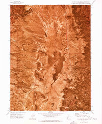
1973 Map of Puddle Valley Knolls
USGS Topo · Published 1977About this map
Puddle Valley Knolls define this arid landscape along the border of Box Elder Co and Tooele Co, where the terrain drops into a significant central Depression. This orthophotomap, produced from aerial photography taken in 1972, reveals a desolate environment where water is the primary concern for any human activity. Life in this remote basin is traced through scattered water sources such as Bertagnole Well and Skunk Ridge Well, which serve as the only vital markers in an otherwise sparsely developed region. To the east, the rising land of Skunk Ridge provides the only major relief against the valley floor, illustrating the extreme isolation of this portion of northern Utah during the early 1970s.
Find a feature on this map
7 named features on this map. Tap any name to fly to it.
Don’t see what you’re looking for? This feature index may not catch every label — zoom into the map to look around manually.
Map Details
Editions of this 1973 Puddle Valley Knolls Map
This is the sole edition of this map. No revisions or reprints were ever made.
Other maps of this area

1885 · Tooele Valley
USGS Topo · 1:250,000

1953 · Tooele
USGS Topo · 1:250,000

1954 · Brigham City
USGS Topo · 1:250,000

1955 · Tooele
USGS Topo · 1:250,000

1958 · Brigham City
USGS Topo · 1:250,000

1962 · Brigham City
USGS Topo · 1:250,000

1968 · Deardens Knoll
USGS Topo · 1:24,000

1968 · Craner Peak
USGS Topo · 1:24,000

1973 · Ripple Valley
USGS Topo · 1:24,000

1973 · Grassy Mountains
USGS Topo · 1:24,000