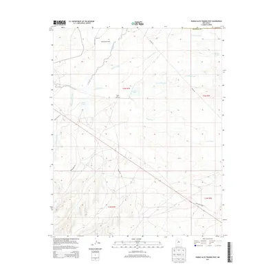
2013 Map of Pueblo Alto Trading Post
USGS Topo · Published 2013About this map
Pueblo Alto Trading Post sits as a central landmark in this high-desert landscape of the Eastern Navajo Agency. The terrain is defined by a sophisticated network of ephemeral drainage systems, most notably the broad Chaco Wash and the deeply incised Burning Bridge Wash. These watercourses dictate the local geography, alongside several named water sources such as Tanner Lake, Castillo Lake, and Raton Spring which have long served as vital points in this arid environment.
Find a feature on this map
22 named features on this map. Tap any name to fly to it.
Don’t see what you’re looking for? This feature index may not catch every label — zoom into the map to look around manually.
Map Details
Editions of this 2013 Pueblo Alto Trading Post Map
This is the sole edition of this map. No revisions or reprints were ever made.
Other maps of this area

1883 · Mt. Taylor
USGS Topo · 1:250,000

1886 · Mt. Taylor
USGS Topo · 1:250,000

1889 · Largo
USGS Topo · 1:250,000

1892 · Mt. Taylor
USGS Topo · 1:250,000

1895 · Largo
USGS Topo · 1:250,000

1899 · Mt. Taylor
USGS Topo · 1:250,000

1954 · Aztec
USGS Topo · 1:250,000

1958 · Aztec
USGS Topo · 1:250,000

1958 · Albuquerque
USGS Topo · 1:250,000

1960 · Pueblo Alto Trading Post
USGS Topo · 1:24,000
Featured Places
- Eastern Navajo Agency, NM
- Tsédááʼtóhí, Eastern Navajo Agency
- Sandoval County, NM
- McKinley County, NM
- United States