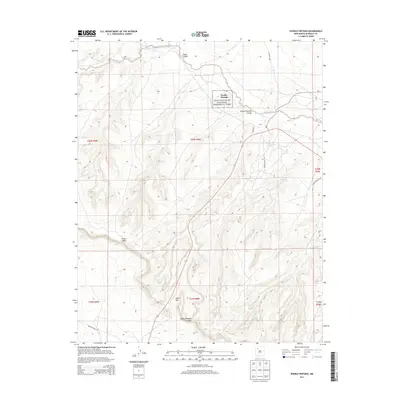
2013 Map of Pueblo Pintado
USGS Topo · Published 2013About this map
Pueblo Pintado stands as a central archaeological and geographical anchor within this high-desert region of the Eastern Navajo Agency. This map details the intersection of ancient history and modern infrastructure, where the Chaco Culture National Historical Park boundary protects significant ancestral sites along Chaco Canyon. The landscape is defined by massive topographic features like Chaco Mesa and carved drainages such as Chaco Wash and Pueblo Pintado Canyon. Transportation across this arid terrain is facilitated by a network of tribal routes, including Navajo Route 7135 and Navajo Route 7134, which weave through the desert toward localized landmarks like Tucker Gap. Sparse water sources, critical to life in this environment, are noted at Ramona Spring and Burro Spring, illustrating the persistent importance of specific hydrologic points in the San Juan Basin.
Find a feature on this map
21 named features on this map. Tap any name to fly to it.
Don’t see what you’re looking for? This feature index may not catch every label — zoom into the map to look around manually.
Map Details
Editions of this 2013 Pueblo Pintado Map
This is the sole edition of this map. No revisions or reprints were ever made.
Other maps of this area

1883 · Mt. Taylor
USGS Topo · 1:250,000

1886 · Mt. Taylor
USGS Topo · 1:250,000

1889 · Largo
USGS Topo · 1:250,000

1892 · Mt. Taylor
USGS Topo · 1:250,000

1895 · Largo
USGS Topo · 1:250,000

1899 · Mt. Taylor
USGS Topo · 1:250,000

1954 · Aztec
USGS Topo · 1:250,000

1958 · Aztec
USGS Topo · 1:250,000

1958 · Albuquerque
USGS Topo · 1:250,000

1960 · Pueblo Alto Trading Post
USGS Topo · 1:24,000
Featured Places
- Eastern Navajo Agency, NM
- Pueblo Pintado, Eastern Navajo Agency
- McKinley County, NM
- United States
- New Mexico