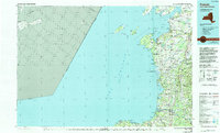
1985 Map of Pulaski
USGS Topo · Published 1994About this map
The eastern shores of Lake Ontario form a transition from open water to the agricultural and woodland landscapes of Jefferson and Oswego Counties in the mid-1980s. This survey illustrates a coastal region defined by its prominent inlets and wildlife areas, including Lakeview State Wildlife Management Area and the beach at Selkirk Shores State Park. Inland, the settlement pattern centers on the Salmon River and established villages like Pulaski and Sackets Harbor. The transportation network is anchored by the Conrail line and rural routes connecting community landmarks such as Belleville Academy and St Marys Church. Dozens of local burial grounds, from Richland Cem to Smithville Cem, offer significant detail for genealogical research, while several family-named locations like Roberts Corner and Aspinwall Corners reflect the area's agricultural history and local landownership.
Find a feature on this map
157 named features on this map. Tap any name to fly to it.
Don’t see what you’re looking for? This feature index may not catch every label — zoom into the map to look around manually.
Map Details
Editions of this 1985 Pulaski Map
2 editions found
Other maps of this area

1893 · Sackets Harbor
USGS Topo · 1:62,500

1895 · Sacketts Harbor
USGS Topo · 1:62,500

1895 · Stony Island
USGS Topo · 1:62,500

1895 · Pulaski
USGS Topo · 1:62,500

1895 · Watertown
USGS Topo · 1:62,500

1895 · Cape Vincent
USGS Topo · 1:62,500

1898 · Watertown
USGS Topo · 1:62,500

1900 · Oswego
USGS Topo · 1:62,500

1900 · Fulton
USGS Topo · 1:62,500

1900 · Clayton
USGS Topo · 1:62,500