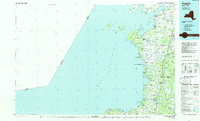
1985 Map of Pulaski
USGS Topo · Published 1985About this map
Lake Ontario defines the western reaches of this 1985 survey, where the shoreline is shaped by a sequence of bays and wildlife management areas. The Salmon River flows through the heart of Pulaski, a village known for its connection to the lake's rich aquatic resources. This era reflects the established regional transport network, anchored by the Conrail rail line and the corridor of Route 81, which connects inland settlements like Adams and Mannsville.
Find a feature on this map
139 named features on this map. Tap any name to fly to it.
Don’t see what you’re looking for? This feature index may not catch every label — zoom into the map to look around manually.
Map Details
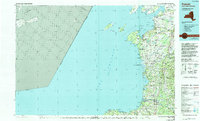
Editions of this 1985 Pulaski Map
2 editions found
Other maps of this area

1893 · Sackets Harbor
USGS Topo · 1:62,500

1895 · Sacketts Harbor
USGS Topo · 1:62,500

1895 · Stony Island
USGS Topo · 1:62,500

1895 · Pulaski
USGS Topo · 1:62,500

1895 · Watertown
USGS Topo · 1:62,500

1895 · Cape Vincent
USGS Topo · 1:62,500

1898 · Watertown
USGS Topo · 1:62,500

1900 · Oswego
USGS Topo · 1:62,500

1900 · Fulton
USGS Topo · 1:62,500

1900 · Clayton
USGS Topo · 1:62,500