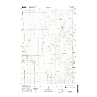
2016 Map of Pulaski
USGS Topo · Published 2016About this map
Pulaski serves as a primary hub where Brown, Oconto, and Shawano Counties converge in this mid-2010s landscape. The area is defined by the branching tributaries of the Little Suamico River and Suamico River, which wind through a patchwork of rural farmstead roads and established settlements like Chase and South Chase. Local history is anchored by several distinct burial grounds, including the Polish National Cem and Saint Joseph Cem, reflecting the cultural heritage of the surrounding townships. To the south, Potter Cr drains toward the village center, while Carter Airport provides a small-scale aviation landmark near the township borders. The network of county highways and named rural lanes, such as Van Dornick Rd and Gohr Rd, illustrates the persistent grid of Wisconsin’s dairy country and its transition into the developing outskirts of Suamico.
Find a feature on this map
125 named features on this map. Tap any name to fly to it.
Don’t see what you’re looking for? This feature index may not catch every label — zoom into the map to look around manually.
Map Details
Editions of this 2016 Pulaski Map
This is the sole edition of this map. No revisions or reprints were ever made.
Other maps of this area

1954 · Green Bay West
USGS Topo · 1:24,000

1954 · Green Bay
USGS Topo · 1:62,500

1955 · Seymour
USGS Topo · 1:62,500

1955 · Green Bay
USGS Topo · 1:250,000

1956 · Gillett
USGS Topo · 1:62,500

1956 · Oconto Falls
USGS Topo · 1:62,500

1974 · Seymour
USGS Topo · 1:24,000

1974 · Abrams
USGS Topo · 1:24,000

1974 · Zachow
USGS Topo · 1:24,000
1974 · Oconto Falls South
USGS Topo · 1:24,000