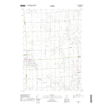
2018 Map of Pulaski
USGS Topo · Published 2018About this map
Pulaski sits at the junction of Brown, Oconto, and Shawano counties, serving as a primary hub in this agricultural and woodland landscape. The village layout shows a concentrated residential and commercial core transitioning into larger rural tracts. To the north and east, the small communities of Chase and South Chase anchor the rural landscape, which is defined by a dense network of local roads such as Van Dornick Rd and Middle Dr.
Find a feature on this map
116 named features on this map. Tap any name to fly to it.
Don’t see what you’re looking for? This feature index may not catch every label — zoom into the map to look around manually.
Map Details
Editions of this 2018 Pulaski Map
This is the sole edition of this map. No revisions or reprints were ever made.
Other maps of this area

1954 · Green Bay West
USGS Topo · 1:24,000

1954 · Green Bay
USGS Topo · 1:62,500

1955 · Seymour
USGS Topo · 1:62,500

1955 · Green Bay
USGS Topo · 1:250,000

1956 · Gillett
USGS Topo · 1:62,500

1956 · Oconto Falls
USGS Topo · 1:62,500

1974 · Seymour
USGS Topo · 1:24,000

1974 · Abrams
USGS Topo · 1:24,000

1974 · Zachow
USGS Topo · 1:24,000
1974 · Oconto Falls South
USGS Topo · 1:24,000