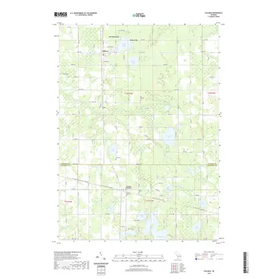
2019 Map of Pullman
USGS Topo · Published 2019About this map
Pullman and Grand Junction anchor this part of Southwest Michigan, situated where the grid of Allegan Co meets Van Buren Co along Baseline Rd. The landscape is defined by a dense concentration of glacial water bodies, from the sprawling Saddle Lake and Silver Lake in the south to Lower Scott Lake and Upper Scott Lake near the northern settlements. This 2019 survey documents the modern layout of these lakeside communities and the rural corridors connecting them, such as Mc Kinley Hwy. Significant for local history and genealogy, the map identifies several burial grounds including Lee Township Cem and Sacred Heart Cem. Outdoor recreation is a prominent modern feature, highlighted by the Kal-Haven Trail State Park which cuts through the southern half of the quadrangle, repurposing a former rail corridor into a continuous trail system.
Find a feature on this map
67 named features on this map. Tap any name to fly to it.
Don’t see what you’re looking for? This feature index may not catch every label — zoom into the map to look around manually.
Map Details
Editions of this 2019 Pullman Map
This is the sole edition of this map. No revisions or reprints were ever made.
Other maps of this area

1927 · Bangor
USGS Topo · 1:62,500

1928 · Fennville
USGS Topo · 1:62,500

1931 · Fennville
USGS Topo · 1:62,500

1931 · Bangor
USGS Topo · 1:62,500

1943 · Bangor
USGS Topo · 1:62,500

1946 · Gobles
USGS Topo · 1:62,500

1948 · Gobles
USGS Topo · 1:62,500

1949 · Gobles
USGS Topo · 1:62,500

1958 · Allegan
USGS Topo · 1:62,500

1958 · Racine
USGS Topo · 1:250,000