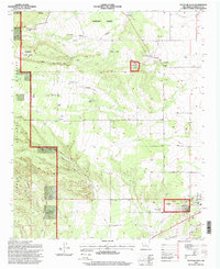
1995 Map of Punta De Agua
USGS Topo · Published 1998About this map
Salinas Ruin National Monument Quarai Division sits at the foot of the Manzano Mountains, preserving the intersection of Puebloan and Spanish history. This mid-1990s revision shows the settlement of Punta de Agua situated just east of the monument, while the town of Mountainair occupies the southeastern corner of the sheet. The landscape is defined by traditional land divisions, including the Manzano Grant, and a network of canyons such as Cañon Colorado and Cañon de la Gotera. Local family history is well represented through named sites like D Candelaria Ranch, Los Chaves, and Kaysers Ranch. Geologists and historians can trace the drainage patterns of Arroyo Abo and the placement of numerous Gravel Pits and wells that supported the high-desert economy of Torrance County during this era.
Find a feature on this map
37 named features on this map. Tap any name to fly to it.
Don’t see what you’re looking for? This feature index may not catch every label — zoom into the map to look around manually.
Map Details
Editions of this 1995 Punta De Agua Map
This is the sole edition of this map. No revisions or reprints were ever made.
Other maps of this area

1917 · Estancia
USGS Topo · 1:125,000

1954 · Capilla Peak
USGS Topo · 1:24,000

1954 · Torreon
USGS Topo · 1:24,000

1954 · Torreon
USGS Topo · 1:62,500

1954 · Socorro
USGS Topo · 1:250,000

1956 · Mountainair
USGS Topo · 1:62,500

1958 · Socorro
USGS Topo · 1:250,000

1962 · Socorro
USGS Topo · 1:250,000

1972 · Abo
USGS Topo · 1:24,000
1972 · Scholle
USGS Topo · 1:24,000