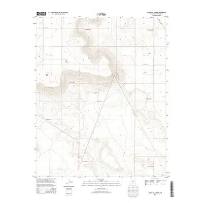
2013 Map of Punta Del Chorro
USGS Topo · Published 2013About this map
Punta del Chorro rises as a prominent landmark in this corner of San Miguel County, anchoring a landscape defined by high mesas and deep drainages. The area is marked by a legacy of ranching and remote settlement, visible in the clusters of buildings at Esquibel and Simpson in the east, and the Conchas Ranch centrally located along CO Road C-48-A. These outposts represent the enduring presence of family-run operations in a dry environment where water sources like Chorro Spring were essential for survival.
Find a feature on this map
21 named features on this map. Tap any name to fly to it.
Don’t see what you’re looking for? This feature index may not catch every label — zoom into the map to look around manually.
Map Details
Editions of this 2013 Punta Del Chorro Map
This is the sole edition of this map. No revisions or reprints were ever made.
Other maps of this area

1892 · Watrous
USGS Topo · 1:125,000

1892 · Corazon
USGS Topo · 1:125,000

1894 · Corazon
USGS Topo · 1:125,000

1894 · Watrous
USGS Topo · 1:125,000

1954 · Santa Fe
USGS Topo · 1:250,000

1958 · Santa Fe
USGS Topo · 1:250,000

1963 · Cactus Tank
USGS Topo · 1:24,000

1963 · Flagstone Mountain
USGS Topo · 1:24,000

1971 · Laguna Huerfana
USGS Topo · 1:24,000

1971 · Trujillo
USGS Topo · 1:24,000