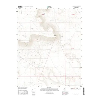
2017 Map of Punta Del Chorro
USGS Topo · Published 2017About this map
Tuloso Cem sits at the northern edge of this high-desert landscape in San Miguel County, a marker of the local settlement history near the drainage of Cañada Tuloso. The terrain is defined by dramatic elevations including the prominent Yegua Mesa and the sharp outcrops of Punta Del Salitre and Punta del Chorro. These landforms overlook a network of seasonal watercourses like Salitre Cr and Corazon Cr, which have historically dictated the placement of travel routes and watering holes. The presence of Chorro Spring tucked against the escarpment suggests a vital water source for the region's ranching interests. This 2017 survey reflects the remote character of northeastern New Mexico, where narrow county roads like Co RD c48a provide the primary access through the broken mesa country.
Find a feature on this map
15 named features on this map. Tap any name to fly to it.
Don’t see what you’re looking for? This feature index may not catch every label — zoom into the map to look around manually.
Map Details
Editions of this 2017 Punta Del Chorro Map
This is the sole edition of this map. No revisions or reprints were ever made.
Other maps of this area

1892 · Watrous
USGS Topo · 1:125,000

1892 · Corazon
USGS Topo · 1:125,000

1894 · Corazon
USGS Topo · 1:125,000

1894 · Watrous
USGS Topo · 1:125,000

1954 · Santa Fe
USGS Topo · 1:250,000

1958 · Santa Fe
USGS Topo · 1:250,000

1963 · Cactus Tank
USGS Topo · 1:24,000

1963 · Flagstone Mountain
USGS Topo · 1:24,000

1971 · Laguna Huerfana
USGS Topo · 1:24,000

1971 · Trujillo
USGS Topo · 1:24,000