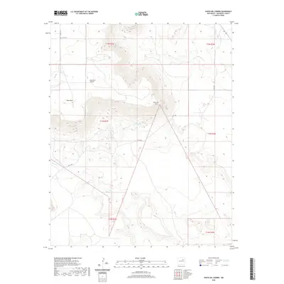
2020 Map of Punta Del Chorro
USGS Topo · Published 2020About this map
Tuloso Cem sits at the northern edge of this high-desert landscape in San Miguel County, where natural water sources like Chorro Spring have historically dictated movement and land use. The terrain is defined by dramatic escarpments and high plateaus, most notably Yegua Mesa and the prominent heights of Punta del Chorro and Punta Del Salitre. These topographical features overlook the drainage systems of Salitre Cr and Corazon Cr, providing a clear view of the natural corridors used for navigation. While modern infrastructure is represented by Co RD c48a, the landscape remains largely defined by its original surveying boundaries and the seasonal flow of drainages like Canada Tuloso.
Find a feature on this map
16 named features on this map. Tap any name to fly to it.
Don’t see what you’re looking for? This feature index may not catch every label — zoom into the map to look around manually.
Map Details
Editions of this 2020 Punta Del Chorro Map
This is the sole edition of this map. No revisions or reprints were ever made.
Other maps of this area

1892 · Watrous
USGS Topo · 1:125,000

1892 · Corazon
USGS Topo · 1:125,000

1894 · Corazon
USGS Topo · 1:125,000

1894 · Watrous
USGS Topo · 1:125,000

1954 · Santa Fe
USGS Topo · 1:250,000

1958 · Santa Fe
USGS Topo · 1:250,000

1963 · Cactus Tank
USGS Topo · 1:24,000

1963 · Flagstone Mountain
USGS Topo · 1:24,000

1971 · Laguna Huerfana
USGS Topo · 1:24,000

1971 · Trujillo
USGS Topo · 1:24,000