1947 Map of Punta Guayanes SO
USGS Topo · Published 1947About this map
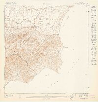
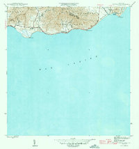
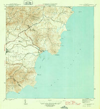
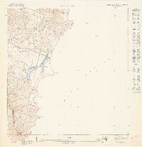
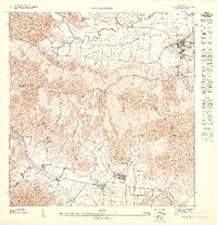
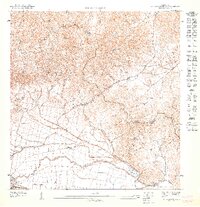
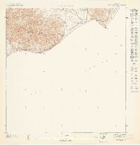
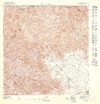
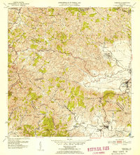
Central Roig anchors the northern coastal plain of this 1947 survey, representing the industrial heart of the region's sugar economy. The landscape is defined by the contrast between the flat Valle de Yabucoa, crisscrossed by irrigation and drainage features like the Caño de Santiago and Zanja, and the steep ascent into the Cuchilla de Panduras. This range dominates the southern half of the sheet, rising toward Cerro Santa Elena and creating a natural barrier between the municipalities of Yabucoa and Maunabo. Along the Mar Caribe, the coastline is marked by prominent points including Pta Quebrada Honda and Pta Yeguas, while a Pyramid Beacon near Puerto Yabucoa indicates the importance of maritime navigation for this coastal agricultural hub.
Find a feature on this map
17 named features on this map. Tap any name to fly to it.
Don’t see what you’re looking for? This feature index may not catch every label — zoom into the map to look around manually.
Map Details
Editions of this 1947 Punta Guayanes SO Map
This is the sole edition of this map. No revisions or reprints were ever made.
Other maps of this area
1945 · Punta Tuna
USGS Topo · 1:30,000
1946 · Punta Guayanes
USGS Topo · 1:30,000

1946 · Yabucoa
USGS Topo · 1:30,000
1947 · Punta Guayanes NE
USGS Topo · 1:10,000
1947 · Yabucoa SE
USGS Topo · 1:10,000
1947 · Punta Guayanes NO
USGS Topo · 1:10,000
1947 · Punta Tuna NE
USGS Topo · 1:10,000
1947 · Yabucoa NE
USGS Topo · 1:10,000
1952 · Yabucoa
USGS Topo · 1:30,000

1952 · Punta Guayanes
USGS Topo · 1:30,000
Featured Places
- Sector El Cocal, Yabucoa
- Sector El Guano, Yabucoa
- Sector La Maloja, Yabucoa
- Sector Los Colones, Yabucoa
- Camino Nuevo, Yabucoa