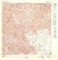
1947 Map of Yabucoa NE
USGS Topo · Published 1947About this map
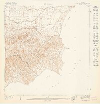
Agricultural operations and mountainous terrain define this 1947 preliminary study of southeastern Puerto Rico. The southeastern quadrant reveals the industrial footprint of Central Roig, a focal point for the local sugar economy connected to the surrounding fields and the small settlement at Colonia Laura. This lowland plain contrasts sharply with the densely contoured interior to the northwest, where the Escuela Calabaza Arriba serves the rural population living among the steep ridges.
Find a feature on this map
12 named features on this map. Tap any name to fly to it.
Don’t see what you’re looking for? This feature index may not catch every label — zoom into the map to look around manually.
Map Details
Editions of this 1947 Yabucoa NE Map
This is the sole edition of this map. No revisions or reprints were ever made.
Other maps of this area

1946 · Humacao
USGS Topo · 1:30,000

1946 · Punta Guayanes
USGS Topo · 1:30,000

1946 · Juncos
USGS Topo · 1:30,000

1946 · Yabucoa
USGS Topo · 1:30,000
1947 · Humacao SO
USGS Topo · 1:10,000

1947 · Yabucoa SO
USGS Topo · 1:10,000
1947 · Yabucoa SE
USGS Topo · 1:10,000
1947 · Punta Guayanes NO
USGS Topo · 1:10,000
1947 · Punta Guayanes SO
USGS Topo · 1:10,000
1947 · Juncos SO
USGS Topo · 1:10,000
Featured Places
- Sector Campo Alegre, Yabucoa
- Sector Los Dávila, Yabucoa
- Sector Acueducto, San Lorenzo
- Laura, Yabucoa
- Las Piedras