1947 Map of Juncos SO
USGS Topo · Published 1947About this map
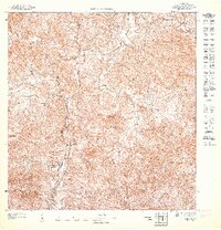
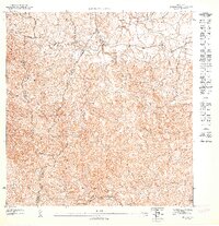
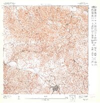
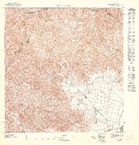
Río Grande and its tributary, Río Cayaguas, carve through the complex interior terrain of San Lorenzo during the mid-1940s. This preliminary topographical study highlights a landscape dominated by drainage networks and scattered rural homesteads, reflecting the agricultural and residential patterns of the period. A significant institutional landmark is the Escuela Segunda Unidad de Quebrada Honda, located near the southern reaches of Quebrada Honda. The naming of numerous smaller streams, such as Quebrada Salvatierra and Quebrada Prieta, indicates the vital importance of water resources to the local community before modern infrastructure became widespread. To the east, the prominent Piedra Blanca provides a natural reference point amidst the dense contour lines of the central hills. The map captures a moment of transition for the region, documented under the authority of the Departamento de lo Interior and Commissioner Jorge J. Jiménez.
Find a feature on this map
7 named features on this map. Tap any name to fly to it.
Don’t see what you’re looking for? This feature index may not catch every label — zoom into the map to look around manually.
Map Details
Editions of this 1947 Juncos SO Map
This is the sole edition of this map. No revisions or reprints were ever made.
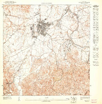
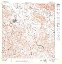
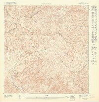
Other maps of this area

1946 · Patillas
USGS Topo · 1:30,000

1946 · Juncos
USGS Topo · 1:30,000

1946 · Yabucoa
USGS Topo · 1:30,000

1946 · Caguas
USGS Topo · 1:30,000
1947 · Caguas NE
USGS Topo · 1:10,000
1947 · Juncos NE
USGS Topo · 1:10,000
1947 · Patillas NE
USGS Topo · 1:10,000
1947 · Juncos SE
USGS Topo · 1:10,000
1947 · Juncos NO
USGS Topo · 1:10,000
1947 · Yabucoa NE
USGS Topo · 1:10,000
Featured Places
- Sector Cubuy, San Lorenzo
- Sector La Loma, San Lorenzo
- Sector Cemí, San Lorenzo
- Sector El Salto, San Lorenzo
- Parcelas Viejas de Jagual, San Lorenzo