1947 Map of Juncos NO
USGS Topo · Published 1947About this map
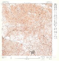
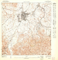
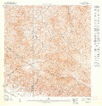
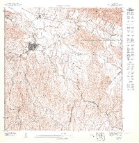
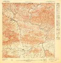
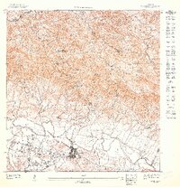
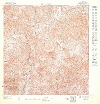
San Lorenzo serves as the focal point of this 1943 topography, situated along the northern bank of the Río Grande de Loíza. This preliminary survey, published by the U.S. Geological Survey in 1947, details the rugged transition from the river valley to the prominent heights of Cerro Santa Ana. The landscape is defined by its hydraulic character, where the Quebrada Doña Dolores and numerous unnamed tributaries carve through the municipal boundaries of Gurabo and Caguas. The dense grid of the San Lorenzo town center contrasts sharply with the dispersed settlement patterns of rural barrios like Cantagallo, reflecting a traditional agricultural society organized around the fertile plains and steep mountain foothills before later industrial development.
Find a feature on this map
7 named features on this map. Tap any name to fly to it.
Don’t see what you’re looking for? This feature index may not catch every label — zoom into the map to look around manually.
Map Details
Editions of this 1947 Juncos NO Map
This is the sole edition of this map. No revisions or reprints were ever made.
Other maps of this area

1946 · Aguas Buenas
USGS Topo · 1:30,000

1946 · Gurabo
USGS Topo · 1:30,000

1946 · Juncos
USGS Topo · 1:30,000

1946 · Caguas
USGS Topo · 1:30,000
1947 · Caguas NE
USGS Topo · 1:10,000
1947 · Gurabo SE
USGS Topo · 1:10,000
1947 · Juncos NE
USGS Topo · 1:10,000
1947 · Aguas Buenas SE
USGS Topo · 1:10,000
1947 · Gurabo SO
USGS Topo · 1:10,000
1947 · Juncos SO
USGS Topo · 1:10,000
Featured Places
- San Lorenzo, San Lorenzo
- Colinas de Navarro, Gurabo
- Sector Montano, Gurabo
- Barriada Zavala, San Lorenzo
- Sector Los Bruseles, San Lorenzo