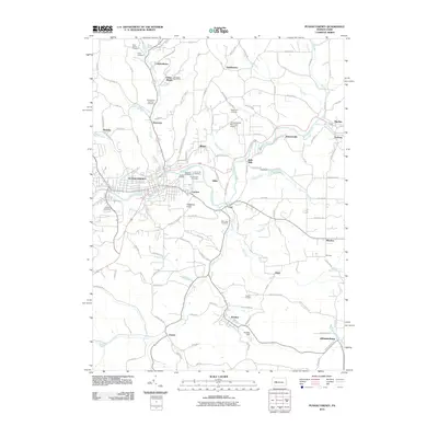
2010 Map of Punxsutawney
USGS Topo · Published 2010About this map
Gobblers Knob rises south of the central borough, a world-famous landmark in this Jefferson County landscape defined by the winding course of Mahoning Creek. This early 21st-century survey documents the transition of the region from a heavy coal and rail hub toward its modern character. The industrial history of the area is still deeply etched in the terrain, visible through the B and O Terminal and Elk Run Junction, alongside legacy extraction sites such as Adrian Mines. Scattered surrounding settlements like Rossiter, Juneau, and Big Run are connected by a dense network of local roads and runs. Numerous cemeteries, including Circle Hill and Oak Lawn, serve as vital touchstones for genealogists tracing the many small communities that grew up around the local mines and mills. Local infrastructure is anchored by the Punxsutawney Municipal Airport and water features like Cloe Lake and Rossiter Dam.
Find a feature on this map
122 named features on this map. Tap any name to fly to it.
Don’t see what you’re looking for? This feature index may not catch every label — zoom into the map to look around manually.
Map Details
Editions of this 2010 Punxsutawney Map
This is the sole edition of this map. No revisions or reprints were ever made.
Other maps of this area

1906 · Punxsutawney
USGS Topo · 1:62,500

1909 · Smicksburg
USGS Topo · 1:62,500

1922 · Du Bois
USGS Topo · 1:62,500

1924 · Du Bois
USGS Topo · 1:62,500

1924 · Brookville
USGS Topo · 1:62,500

1926 · Brookville
USGS Topo · 1:62,500

1938 · Smicksburg
USGS Topo · 1:62,500

1939 · Smicksburg
USGS Topo · 1:62,500

1939 · Punxsutawney
USGS Topo · 1:62,500

1942 · Punxsutawney
USGS Topo · 1:62,500