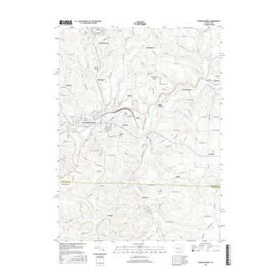
2016 Map of Punxsutawney
USGS Topo · Published 2016About this map
Gobblers Knob stands south of the historic borough of Punxsutawney, serving as the most recognized landmark in a region defined by its narrow valleys and persistent coal-town legacy. This survey reveals the dense arrangement of cemetery sites that anchor the local genealogy, including Circle Hill Cem, Greenwood Cem, and Saints Peter and Paul Cem. The landscape is etched by the Mahoning Creek and its many tributaries, such as Elk Run and Canoe Cr, which once dictated the placement of small mining and rail settlements like Anita, Riker, and Rossiter. Modern infrastructure, including the Punxsutawney Municipal Airport, occupies the high ground north of Bells Mills, while the eastern portion of the map transitions into the quieter waters of Cloe Lake and the rural reaches of Big Run.
Find a feature on this map
135 named features on this map. Tap any name to fly to it.
Don’t see what you’re looking for? This feature index may not catch every label — zoom into the map to look around manually.
Map Details
Editions of this 2016 Punxsutawney Map
This is the sole edition of this map. No revisions or reprints were ever made.
Other maps of this area

1906 · Punxsutawney
USGS Topo · 1:62,500

1909 · Smicksburg
USGS Topo · 1:62,500

1922 · Du Bois
USGS Topo · 1:62,500

1924 · Du Bois
USGS Topo · 1:62,500

1924 · Brookville
USGS Topo · 1:62,500

1926 · Brookville
USGS Topo · 1:62,500

1938 · Smicksburg
USGS Topo · 1:62,500

1939 · Smicksburg
USGS Topo · 1:62,500

1939 · Punxsutawney
USGS Topo · 1:62,500

1942 · Punxsutawney
USGS Topo · 1:62,500