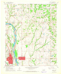
1965 Map of Purcell
USGS Topo · Published 1966About this map
The Canadian River serves as the central artery and dividing line in this mid-1960s landscape, separating the developing town of Purcell in McClain County from Lexington in Cleveland County. The influence of the Atchison Topeka and Santa Fe railroad is evident in the layout of Purcell, where the tracks run parallel to the river and the urban grid. Beyond the town centers, the map documents a rural transition marked by several small community institutions like the Canada Sch and Simpson Sch, and numerous burial grounds including Dripping Springs Cem and Banner Cem. Notable industrial activity is indicated by the Northeast Gibbon Spur Oil Field and various Gravel Pits north of town. Of particular historical interest is the Indian Treaty Boundary, which cuts across the river valley, marking a legacy of territorial division in the Oklahoma landscape.
Find a feature on this map
40 named features on this map. Tap any name to fly to it.
Don’t see what you’re looking for? This feature index may not catch every label — zoom into the map to look around manually.
Map Details
Editions of this 1965 Purcell Map
2 editions found
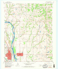
Other maps of this area

1893 · Norman
USGS Topo · 1:62,500

1898 · Purcell
USGS Topo · 1:125,000

1898 · Pauls Valley
USGS Topo · 1:125,000

1902 · Pauls Valley
USGS Topo · 1:125,000

1910 · McComb
USGS Topo · 1:62,500

1925 · Norman NO 2
USGS Topo · 1:24,000

1936 · Norman
USGS Topo · 1:62,500

1954 · Oklahoma City
USGS Topo · 1:250,000

1957 · Ardmore
USGS Topo · 1:250,000

1957 · Oklahoma City
USGS Topo · 1:250,000