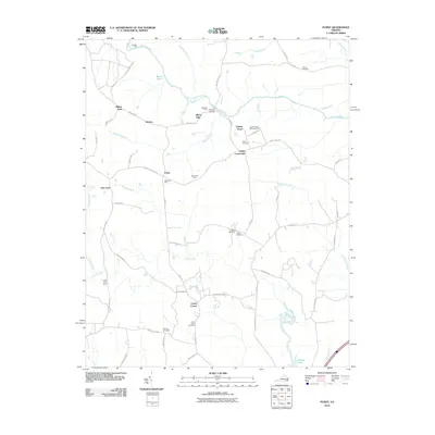
2010 Map of Purdy
USGS Topo · Published 2010About this map
The Nottoway River and its major tributaries, including Three Creek and Hardwood Creek, carve a rural landscape in southern Virginia defined by a legacy of family farming and religious community. At Fields Crossroads, the intersection of Purdy Rd and Wyatts Mill Rd serves as a geographic anchor for nearby agricultural landmarks like Elm Grove Farm and Orion Vue Farm.
Find a feature on this map
64 named features on this map. Tap any name to fly to it.
Don’t see what you’re looking for? This feature index may not catch every label — zoom into the map to look around manually.
Map Details
Editions of this 2010 Purdy Map
This is the sole edition of this map. No revisions or reprints were ever made.
Other maps of this area

1919 · Jarratt
USGS Topo · 1:62,500

1919 · Mc Kenney
USGS Topo · 1:48,000

1919 · Emporia
USGS Topo · 1:62,500

1919 · Arringdale
USGS Topo · 1:48,000

1920 · Arringdale
USGS Topo · 1:62,500

1921 · Mc Kenney
USGS Topo · 1:62,500

1942 · Arringdale
USGS Topo · 1:62,500

1942 · Emporia
USGS Topo · 1:62,500

1943 · Mc Kenney
USGS Topo · 1:62,500

1951 · Jarratt
USGS Topo · 1:62,500