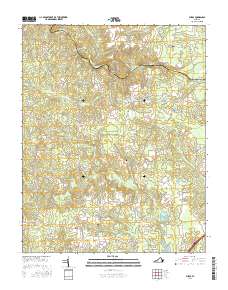
2016 Map of Purdy
USGS Topo · Published 2016About this map
The Nottoway River meanders along the boundary of Sussex Co and Greenville Co, defining a landscape of complex drainage basins and small rural communities. The settlement of Purdy serves as a central point in this southern Virginia territory, surrounded by a network of family and historic sites including Trisvan Cem and Saint Johns Cem. The terrain is characterized by extensive wetlands such as Otterdam Swamp and Moores Swamp, which have historically influenced road patterns and land use. Local transport is anchored by routes like Purdy Rd and Wyatts Mill Rd, connecting residents to Fields Crossroads and the Double Bridge crossing. The presence of Slagle's Lake and numerous creeks like Three Cr and Cattail Cr highlights the water-rich nature of the region, which has long supported timber and agricultural interests in this part of the Tidewater area.
Find a feature on this map
49 named features on this map. Tap any name to fly to it.
Don’t see what you’re looking for? This feature index may not catch every label — zoom into the map to look around manually.
Map Details
Editions of this 2016 Purdy Map
This is the sole edition of this map. No revisions or reprints were ever made.
Other maps of this area

1919 · Jarratt
USGS Topo · 1:62,500

1919 · Mc Kenney
USGS Topo · 1:48,000

1919 · Emporia
USGS Topo · 1:62,500

1919 · Arringdale
USGS Topo · 1:48,000

1920 · Arringdale
USGS Topo · 1:62,500

1921 · Mc Kenney
USGS Topo · 1:62,500

1942 · Arringdale
USGS Topo · 1:62,500

1942 · Emporia
USGS Topo · 1:62,500

1943 · Mc Kenney
USGS Topo · 1:62,500

1951 · Jarratt
USGS Topo · 1:62,500