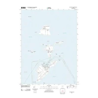
2011 Map of Put-in-Bay
USGS Topo · Published 2011About this map
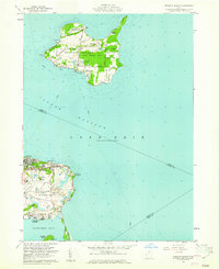
South Bass Island and its smaller neighbors anchor this maritime study of the Bass Islands in western Lake Erie. The village of Put-in-Bay serves as a central hub, where travelers arriving via the Port Clinton-Put-in-Bay ferry line find a landscape defined by seasonal commerce and historical memory. Significant landmarks include the Perry Memorial Monument Light on the eastern shore and the Boardwalk near Gibraltar Bar. Farther north, the map details Middle Bass Island and the more isolated Isle Saint George on North Bass Island, each maintaining its own community identity with local post offices and cemeteries such as the Middle Bass Island Cemetery and North Bass Island Cemetery. The map also captures the smaller, surrounding landforms like Rattlesnake Island, Sugar Island, and Ballast Island, which navigate the complex limestone reefs and deep waters of the archipelago.
Find a feature on this map
55 named features on this map. Tap any name to fly to it.
Don’t see what you’re looking for? This feature index may not catch every label — zoom into the map to look around manually.
Map Details
Editions of this 2011 Put-in-Bay Map
This is the sole edition of this map. No revisions or reprints were ever made.
Other maps of this area

1901 · Put-In-Bay
USGS Topo · 1:62,500

1903 · Put In Bay
USGS Topo · 1:62,500

1916 · Kelleys Island
USGS Topo · 1:62,500

1919 · Kelleys Island
USGS Topo · 1:62,500

1956 · Toledo
USGS Topo · 1:250,000
1959 · Port Clinton
USGS Topo · 1:24,000
1959 · Gypsum
USGS Topo · 1:24,000
1959 · Put-In-Bay
USGS Topo · 1:24,000
1959 · Kelleys Island
USGS Topo · 1:24,000

1961 · Toledo
USGS Topo · 1:250,000