
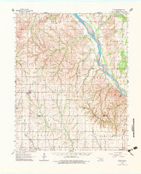
1962 Map of Putnam
USGS Topo · Published 1964About this map
The Canadian River carves a deep valley through the high plains of western Oklahoma, marking a sharp topographic divide between the township lands of Dewey and Little Robe. This early 1960s survey documents a rural landscape defined by its section-line roads and numerous small community centers, such as Putnam, located along the Atchison Topeka and Santa Fe railroad line. The map is particularly rich for genealogical research, identifying several country churches and isolated burial grounds including Roseland Ch, Bethel Cem Ch, and Merck Cem. Industrial activity is evident in the scattered distribution of Oil Wells, Gas Wells, and Drill Holes that signal the region's mid-century energy development. The terrain is deeply dissected by tributaries like Trail Creek and Fiddlers Creek, which create the rugged breaks that characterize this portion of the Oklahoma panhandle's edge.
Find a feature on this map
37 named features on this map. Tap any name to fly to it.
Don’t see what you’re looking for? This feature index may not catch every label — zoom into the map to look around manually.
Map Details
Editions of this 1962 Putnam Map
2 editions found
Other maps of this area

1955 · Clinton
USGS Topo · 1:250,000

1955 · Woodward
USGS Topo · 1:250,000

1957 · Clinton
USGS Topo · 1:250,000

1957 · Butler
USGS Topo · 1:62,500

1957 · Clinton
USGS Topo · 1:62,500

1958 · Woodward
USGS Topo · 1:250,000

1962 · Aledo
USGS Topo · 1:62,500

1964 · Oakwood
USGS Topo · 1:62,500

1964 · Weatherford
USGS Topo · 1:62,500

1969 · Lenora
USGS Topo · 1:24,000