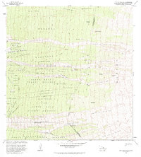
1982 Map of Puu Pohakuloa
USGS Topo · Published 1984About this map
South Kona Forest Reserve dominates this 1980s landscape, illustrating the intersection of volcanic activity and land tenure in Hawaii. The map documents several historic agricultural and residential divisions, including the Haukalua Homesteads, Kukuiopae Homesteads, and Opihihali Homesteads. These narrow land units reflect traditional land management patterns adapted for modern habitation.
Find a feature on this map
53 named features on this map. Tap any name to fly to it.
Don’t see what you’re looking for? This feature index may not catch every label — zoom into the map to look around manually.
Map Details
Editions of this 1982 Puu Pohakuloa Map
2 editions found
Other maps of this area

1924 · Honuapo
USGS Topo · 1:62,500

1928 · Mauna Loa
USGS Topo · 1:62,500

1928 · Hoopuloa
USGS Topo · 1:62,500

1954 · Hawaii South
USGS Topo · 1:250,000

1959 · Hawaii South
USGS Topo · 1:250,000

1959 · Honaunau
USGS Topo · 1:24,000
1960 · Kaunene
USGS Topo · 1:24,000

1961 · Hawaii South
USGS Topo · 1:250,000

1962 · Hawaii South
USGS Topo · 1:250,000

1962 · Milolii
USGS Topo · 1:24,000