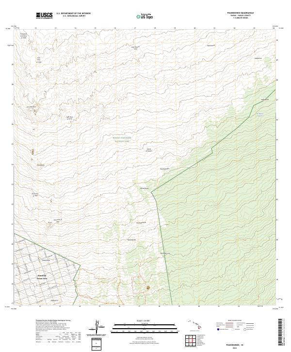
2024 Map of Puuokeokeo
USGS Topo · Published 2024About this map
Hawai‘i Volcanoes National Park dominates the eastern half of this landscape, where the island's volcanic activity is recorded in a series of distinct chronological events. The terrain is a chronological record of Mauna Loa's eruptions, featuring the Lava Flow of 1950, the Ho‘ōpūloa Lava Flow of 1926, and several earlier nineteenth-century events such as the Lava Flow of 1887. These flows create a stark environment where patches of older vegetation, or kīpuka, survive amidst the cooled rock, including Kipukapāhipa and Kipukanēnē. In the southwest corner, the residential grid of Hawaiian Ocean View and the settlement of Halepōhāhā mark the edge of modern habitation. Extensive street networks like Ocean View Pkwy and Marlin Blvd contrast sharply with the neighboring volcanic wilderness. Notable landmarks such as Pu‘u‘oke‘oke‘o and the historic Kahuku Kona Trl provide points of reference across this evolving geological surface.
Find a feature on this map
43 named features on this map. Tap any name to fly to it.
Don’t see what you’re looking for? This feature index may not catch every label — zoom into the map to look around manually.
Map Details
Editions of this 2024 Puuokeokeo Map
This is the sole edition of this map. No revisions or reprints were ever made.
Other maps of this area

1924 · Honuapo
USGS Topo · 1:62,500

1928 · Mauna Loa
USGS Topo · 1:62,500

1928 · Hoopuloa
USGS Topo · 1:62,500

1954 · Hawaii South
USGS Topo · 1:250,000

1959 · Hawaii South
USGS Topo · 1:250,000

1961 · Hawaii South
USGS Topo · 1:250,000

1962 · Hawaii South
USGS Topo · 1:250,000

1962 · Kahuku Ranch
USGS Topo · 1:24,000

1962 · Pohue Bay
USGS Topo · 1:24,000

1962 · Papa
USGS Topo · 1:24,000