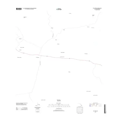
2013 Map of Puuoo
USGS Topo · Published 2013About this map
The volcanic expanses of the Island of Hawai'i are documented here through a series of historic geological events. This high-altitude landscape is dominated by the intersecting paths of numerous eruptions, including the Lava Flow of 1843, Lava Flow of 1935, and the Lava Flow of 1881. These flows converge near the Humu'ula Saddle, a critical geographical corridor between the island's massive peaks. Evidence of human presence and infrastructure appears via the Mauna Kea Access Rd and Mauna Loa Access Rd, which facilitate movement through this austere environment. The Pu'u'o'o Ranch stands as a notable landmark of high-country land use, while various cinder cones and topographical features like Pu'uhuluhulu and Pu'unene define the surrounding horizon. The intricate drainage patterns of the Waikahalulu Gulch and Waiaama Gulch further illustrate the complex hydrology of the volcanic slopes.
Find a feature on this map
24 named features on this map. Tap any name to fly to it.
Don’t see what you’re looking for? This feature index may not catch every label — zoom into the map to look around manually.
Map Details
Editions of this 2013 Puuoo Map
This is the sole edition of this map. No revisions or reprints were ever made.
Other maps of this area

1927 · Kaohe
USGS Topo · 1:62,500

1930 · Humuula
USGS Topo · 1:62,500

1930 · Kaohe
USGS Topo · 1:62,500

1954 · Hawaii North
USGS Topo · 1:250,000

1956 · Puu Oo
USGS Topo · 1:24,000

1956 · Pua Akala
USGS Topo · 1:24,000

1956 · Puu Koli
USGS Topo · 1:24,000

1956 · Upper Piihonua
USGS Topo · 1:24,000
1956 · Puu Ulaula
USGS Topo · 1:24,000
1956 · Kulani
USGS Topo · 1:24,000