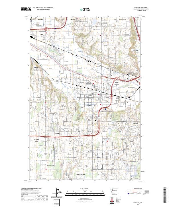
2023 Map of Puyallup
USGS Topo · Published 2023About this map
The Puyallup River carves a deep path through the Puyallup Valley, creating a landscape defined by its fertile floodplains and rising glacial plateaus. Modern infrastructure and residential development dominate the heights of South Hill and Summit, while the river corridor maintains its role as a transportation and industrial artery. The valley floor is marked by significant historical waypoints such as Meeker and Alderton, alongside prominent local landmarks including Pierce College at Puyallup.
Find a feature on this map
46 named features on this map. Tap any name to fly to it.
Don’t see what you’re looking for? This feature index may not catch every label — zoom into the map to look around manually.
Map Details
Editions of this 2023 Puyallup Map
This is the sole edition of this map. No revisions or reprints were ever made.
Other maps of this area

1897 · Tacoma
USGS Topo · 1:125,000

1900 · Tacoma
USGS Topo · 1:125,000

1941 · Tacoma South
USGS Topo · 1:62,500

1942 · Lake Tapps
USGS Topo · 1:62,500

1944 · Lake Tapps
USGS Topo · 1:62,500

1944 · Tacoma South
USGS Topo · 1:62,500

1949 · Tacoma North
USGS Topo · 1:24,000

1949 · Poverty Bay
USGS Topo · 1:24,000

1949 · Auburn
USGS Topo · 1:24,000

1956 · Orting
USGS Topo · 1:24,000