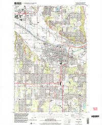
1997 Map of Puyallup
USGS Topo · Published 2003About this map
Puyallup River valleys and the surrounding upland plateaus define this region during a period of significant suburban expansion and commercial development. The map details the core of Puyallup, showing the dense urban grid near Sparks Stadium and the expansive Western Washington State Fair Grounds. Local history is anchored at the Fort Maloney Historical Marker, while the transition toward modern retail centers is evidenced by the prominent South Hill Mall on South Hill.
Find a feature on this map
69 named features on this map. Tap any name to fly to it.
Don’t see what you’re looking for? This feature index may not catch every label — zoom into the map to look around manually.
Map Details
Editions of this 1997 Puyallup Map
This is the sole edition of this map. No revisions or reprints were ever made.
Other maps of this area

1897 · Tacoma
USGS Topo · 1:125,000

1900 · Tacoma
USGS Topo · 1:125,000

1941 · Tacoma South
USGS Topo · 1:62,500

1942 · Lake Tapps
USGS Topo · 1:62,500

1944 · Lake Tapps
USGS Topo · 1:62,500

1944 · Tacoma South
USGS Topo · 1:62,500

1949 · Tacoma North
USGS Topo · 1:24,000

1949 · Poverty Bay
USGS Topo · 1:24,000

1949 · Auburn
USGS Topo · 1:24,000

1956 · Orting
USGS Topo · 1:24,000