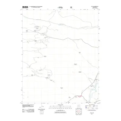
2011 Map of Puye
USGS Topo · Published 2011About this map
Puye Cliff Dwellings National Historic Landmark anchors this study of the plateau above the Rio Grande. This New Mexico landscape is defined by its deep arroyos and canyons, including Guaje Canyon, Bayo Canyon, and Rendija Canyon, which carve through the volcanic tuff. This 2011 survey documents a corridor where ancient habitation sites and modern industrial extraction coexist. Extensive mining activity is evident across the central and northern reaches, marked by the General Pumice Mine, Copar Mine, and White Eagle Pumice Mine. Transport across this challenging terrain is facilitated by Indian Service Route 602 and Indian Service Route 608, connecting the settlements of Puye, Totavi, and Otowi near the Otowi Bridge.
Find a feature on this map
30 named features on this map. Tap any name to fly to it.
Don’t see what you’re looking for? This feature index may not catch every label — zoom into the map to look around manually.
Map Details
Editions of this 2011 Puye Map
This is the sole edition of this map. No revisions or reprints were ever made.
Other maps of this area

1892 · Santa Clara
USGS Topo · 1:125,000

1918 · Abiquiu
USGS Topo · 1:125,000

1952 · White Rock
USGS Topo · 1:24,000

1952 · Frijoles
USGS Topo · 1:24,000

1952 · Puye
USGS Topo · 1:24,000

1952 · Guaje Mountain
USGS Topo · 1:24,000

1953 · Espanola
USGS Topo · 1:24,000

1953 · Chili
USGS Topo · 1:24,000

1953 · Vallecitos
USGS Topo · 1:24,000

1953 · San Juan Pueblo
USGS Topo · 1:24,000