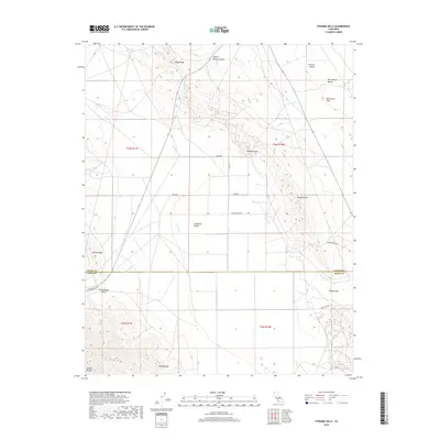
2018 Map of Pyramid Hills
USGS Topo · Published 2018About this map
Pyramid Hills and the southern reaches of the Diablo Range dominate this landscape along the border of Kings and Kern Counties. The terrain transitions from the high elevations of Reef Ridge and Avenal Ridge down into the expansive San Joaquin Valley, specifically crossing the Kettleman Plain and Sunflower Valley. This intersection of topography and hydrology is marked by seasonal drainages like Avenal Cr and Cottonwood Cr, which carve through the ridges at points such as Deadman Gap. The presence of Indian Rocks in the southwest corner and the isolated passage at Dagany Gap reflect the complex geological folds of the region. A sparse network of rural routes, including Devils Den Rd and Xenia Ave, provides the only modern infrastructure through this ranching and oil-adjacent corridor.
Find a feature on this map
25 named features on this map. Tap any name to fly to it.
Don’t see what you’re looking for? This feature index may not catch every label — zoom into the map to look around manually.
Map Details
Editions of this 2018 Pyramid Hills Map
This is the sole edition of this map. No revisions or reprints were ever made.
Other maps of this area

1914 · Lost Hills
USGS Topo · 1:125,000

1914 · Cholame
USGS Topo · 1:125,000

1915 · Cholame
USGS Topo · 1:125,000

1917 · Cholame
USGS Topo · 1:125,000

1930 · Avenal Gap
USGS Topo · 1:31,680

1930 · Kettleman Plain
USGS Topo · 1:31,680

1930 · Middle Dome
USGS Topo · 1:31,680

1933 · Avenal Gap
USGS Topo · 1:31,680

1933 · Kettleman Plain
USGS Topo · 1:31,680

1934 · Reef Ridge
USGS Topo · 1:31,680