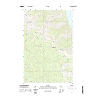
2020 Map of Pyramid Mountain
USGS Topo · Published 2020About this map
The Chelan Mountains dominate this high-elevation wilderness within the Wenatchee National Forest, where the terrain drops sharply toward the eastern shore of Lake Chelan. This landscape is defined by its massive peaks and ridges, including Cardinal Peak, Emerald Peak, and Pyramid Mountain. The drainage patterns here are complex, with waters flowing from high points like Bearcat Ridge and Pugh Ridge toward the Entiat River and its northern fork. The map illustrates a network of named drainages such as Silver Cr and Crow Cr that carve through the steep topography. Significant geographic transition points like Grouse Pass offer a glimpse into the natural corridors through this high-altitude section of the Cascades, where the elevation changes support a variety of ecological zones within the forest boundaries.
Find a feature on this map
43 named features on this map. Tap any name to fly to it.
Don’t see what you’re looking for? This feature index may not catch every label — zoom into the map to look around manually.
Map Details
Editions of this 2020 Pyramid Mountain Map
This is the sole edition of this map. No revisions or reprints were ever made.
Other maps of this area

1899 · Methow
USGS Topo · 1:125,000

1901 · Chelan
USGS Topo · 1:125,000

1901 · Methow
USGS Topo · 1:125,000

1901 · Chiwaukum
USGS Topo · 1:125,000

1902 · Stehekin
USGS Topo · 1:125,000

1904 · Stehekin
USGS Topo · 1:125,000

1904 · Chiwaukum
USGS Topo · 1:125,000

1944 · Lucerne
USGS Topo · 1:62,500

1949 · Lucerne
USGS Topo · 1:62,500

1955 · Concrete
USGS Topo · 1:250,000