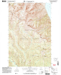
2004 Map of Pyramid Mountain
USGS Topo · Published 2008About this map
Entiat Mountains dominate this high-elevation landscape where the Wenatchee National Forest meets the Lake Chelan shoreline. The map reveals a complex network of high ridges, including Pugh Ridge, Duncan Ridge, and Silver Ridge, which define the drainage basins for the Entiat River and its tributaries like Pope Creek. This area serves as a critical transition between the deep waters of the lake and the protected alpine environments of the Glacier Peak Wilderness.
Find a feature on this map
35 named features on this map. Tap any name to fly to it.
Don’t see what you’re looking for? This feature index may not catch every label — zoom into the map to look around manually.
Map Details
Editions of this 2004 Pyramid Mountain Map
This is the sole edition of this map. No revisions or reprints were ever made.
Other maps of this area

1899 · Methow
USGS Topo · 1:125,000

1901 · Chelan
USGS Topo · 1:125,000

1901 · Methow
USGS Topo · 1:125,000

1901 · Chiwaukum
USGS Topo · 1:125,000

1902 · Stehekin
USGS Topo · 1:125,000

1904 · Stehekin
USGS Topo · 1:125,000

1904 · Chiwaukum
USGS Topo · 1:125,000

1944 · Lucerne
USGS Topo · 1:62,500

1949 · Lucerne
USGS Topo · 1:62,500

1955 · Concrete
USGS Topo · 1:250,000