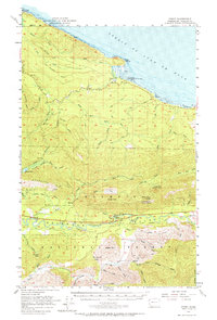
1957 Map of Pysht
USGS Topo · Published 1964About this map
The Strait of Juan de Fuca coastline defines the northern boundary of this mid-century survey, where the settlement of Pysht sits near the mouth of the Pysht River. The landscape is heavily marked by the timber and transport history of Clallam County, evidenced by the extensive Old Railroad Grade that winds through the hills. This network of former rail lines, coupled with features like the Kloshe Nanich Lookout (Aband) and the Snider Ranger Sta, illustrates a transition in land management within the Olympic National Forest.
Find a feature on this map
46 named features on this map. Tap any name to fly to it.
Don’t see what you’re looking for? This feature index may not catch every label — zoom into the map to look around manually.
Map Details
Editions of this 1957 Pysht Map
3 editions found
Other maps of this area

1918 · Lake Crescent
USGS Topo · 1:62,500

1922 · Pysht
USGS Topo · 1:62,500

1922 · Lake Crescent
USGS Topo · 1:62,500

1935 · Clallam
USGS Topo · 1:62,500

1935 · Lake Pleasant
USGS Topo · 1:62,500

1939 · Forks
USGS Topo · 1:62,500

1939 · Mount Tom
USGS Topo · 1:62,500

1942 · Pysht
USGS Topo · 1:62,500

1942 · Clallam
USGS Topo · 1:62,500

1942 · Lake Pleasant
USGS Topo · 1:62,500