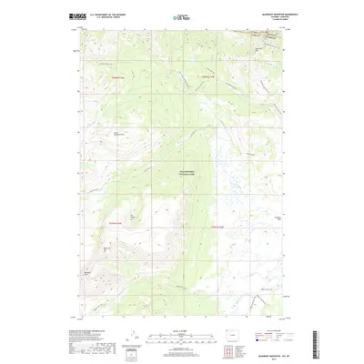
2017 Map of Quadrant Mountain
USGS Topo · Published 2017About this map
Yellowstone National Park dominates this terrain, revealing a high-altitude wilderness defined by massive peaks and an intricate network of backcountry trails along the Wyoming and Montana border. The northern landscape is anchored by the imposing Sepulcher Mtn and Quadrant Mtn, while the Gardner River and its various tributaries, such as Glen Cr and Fawn Cr, carve through the valleys. The map illustrates a primitive transportation network consisting of named routes like the Sportsman Lake Trail and Fawn Pass Trail, which connect isolated features like Gardners Hole and the high basins of The Pocket. This topography showcases the drainage patterns into Cache Lake and the Panther Cr system, providing a detailed look at the backcountry as it was managed in the early 21st century.
Find a feature on this map
28 named features on this map. Tap any name to fly to it.
Don’t see what you’re looking for? This feature index may not catch every label — zoom into the map to look around manually.
Map Details
Editions of this 2017 Quadrant Mountain Map
This is the sole edition of this map. No revisions or reprints were ever made.
Other maps of this area

1885 · Gallatin
USGS Topo · 1:125,000

1885 · Gallatin
USGS Topo · 1:125,000

1891 · Livingston
USGS Topo · 1:250,000

1893 · Livingston
USGS Topo · 1:250,000

1901 · Gallatin
USGS Topo · 1:125,000

1908 · Gallatin
USGS Topo · 1:125,000

1911 · Gallatin
USGS Topo · 1:125,000

1947 · Bozeman
USGS Topo · 1:250,000

1948 · Bozeman
USGS Topo · 1:250,000

1955 · Bozeman
USGS Topo · 1:250,000